
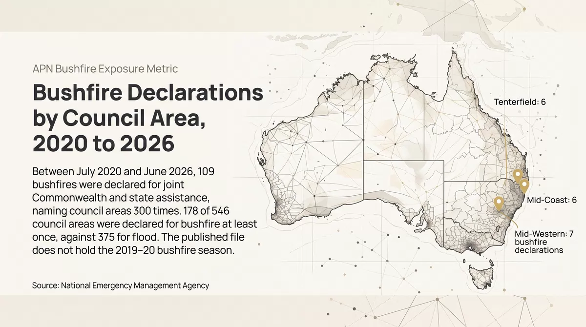

Between July 2020 and June 2026, 109 bushfires were declared for joint Commonwealth and state assistance, and council areas were named in them 300 times. 178 of the country’s 546 council areas were declared for bushfire at least once, against 375 for flood, and 251 of the 300 declarations fall in the last three of the six years. The count begins after the bushfire season of 2019–20, which is not in the published file.
The period starts after the 2019–20 bushfire season, which the file does not hold. A declaration opens government assistance and is not a measure of area burnt, damage or risk.
What is measured, and what is missing
The Disaster Recovery Funding Arrangements are a cost-sharing arrangement between the Commonwealth and the states and territories, under which assistance is opened after a natural disaster. Each activation names the council areas it covers, and the National Emergency Management Agency publishes the list with the hazard it assigns to each event.
This article counts the events the agency lists as bushfires, for events that started between 1 July 2020 and 30 June 2026. An event is one activation. A bushfire declaration is one council area named in one bushfire event. A declaration covers a whole council area whatever share of it burnt, and it shows that assistance was opened, not how much land or how many buildings were burnt.
The file holds a small number of New South Wales bushfire events from 2017 to early 2019, and then no bushfire event of any kind until August 2020. The fires of the 2019–20 season are therefore absent, and nothing here describes them. The agency’s listing gives the dataset a reference period starting in 2006, so a reader of the source should not take the gap to mean that those fires went undeclared. The six years counted are those in which the file’s entries appear to run without a break. Companion articles cover every declared disaster by council area and flood declarations over the same period.
Year by year
Council-area bushfire declarations by year, July 2020 to June 2026
APN calculation based on National Emergency Management Agency data: DRFA Activation History by LGA, bushfire events starting 1 July 2020 to 30 June 2026, file of 11 August 2026. Bushfire declarations by the financial year in which the event started, with the number of separate bushfire events beside each bar. A bushfire declaration is one council area named in one event that the agency lists as a bushfire and that was activated under the Disaster Recovery Funding Arrangements. One Victorian event of February 2024, listed as bushfire and storm, is included.
The first three years had 49 bushfire declarations between them. The last three had 251, which is 84% of the six-year total. The year to June 2024 had the most declarations, 114, and the year to June 2026 had the most separate events, 39.
| Year to June | NSW | Vic. | Qld | SA | WA | Tas. | NT | All |
|---|---|---|---|---|---|---|---|---|
| 2020–21 | 0 | 0 | 3 | 0 | 2 | 0 | 13 | 18 |
| 2021–22 | 0 | 0 | 0 | 0 | 3 | 0 | 0 | 3 |
| 2022–23 | 27 | 0 | 1 | 0 | 0 | 0 | 0 | 28 |
| 2023–24 | 40 | 41 | 25 | 0 | 2 | 0 | 6 | 114 |
| 2024–25 | 15 | 9 | 13 | 0 | 0 | 5 | 0 | 42 |
| 2025–26 | 29 | 31 | 29 | 0 | 0 | 6 | 0 | 95 |
| Six years | 111 | 81 | 71 | 0 | 7 | 11 | 19 | 300 |
| Bushfire events | 69 | 7 | 24 | 0 | 4 | 3 | 2 | 109 |
APN calculation based on National Emergency Management Agency data: DRFA Activation History by LGA, bushfire events starting 1 July 2020 to 30 June 2026, file of 11 August 2026. Bushfire declarations by state and by the financial year in which the event started. The last row counts separate events. South Australia and the Australian Capital Territory had none. A bushfire declaration is one council area named in one event that the agency lists as a bushfire and that was activated under the Disaster Recovery Funding Arrangements. One Victorian event of February 2024, listed as bushfire and storm, is included.
New South Wales had no bushfire declaration in the first two years and 111 in the four years after. 13 of the 18 declarations in 2020–21 come from a single Northern Territory event. South Australia had no bushfire declaration in the six years.
Many small events, two large ones
64 of the 109 bushfire events named one council area, and New South Wales accounts for 69 of the events. Victoria is the opposite case: it had 7 events, and two of them, in February 2024 and January 2026, named 38 and 29 council areas. Those two events account for 67 of Victoria’s 81 declarations. The February 2024 event is listed by the agency as bushfire and storm together, so some of the council areas in it may have been named for storm damage.
States decide when to seek activation and how to divide a fire season into events. New South Wales records many separate fires, while the two large Victorian events each cover fires across much of the state. The number of events is not comparable between states for that reason, and the number of declarations only partly so.
When bushfire events start
Bushfire events by the month in which they started
APN calculation based on National Emergency Management Agency data: DRFA Activation History by LGA, bushfire events starting 1 July 2020 to 30 June 2026, file of 11 August 2026. The 109 bushfire events by the month in which each started, shown from July to June.
53 of the 109 events started in spring and 48 in summer. December has the most, with 27. No event started in May, June or July. 51 of the 53 spring events are in Queensland or New South Wales.
How often council areas are declared for bushfire
Council areas by number of bushfire declarations, July 2020 to June 2026
APN calculation based on National Emergency Management Agency data: DRFA Activation History by LGA, bushfire events starting 1 July 2020 to 30 June 2026, file of 11 August 2026. The 546 council areas with a population estimate, by number of bushfire declarations, with the share of their residents beside each bar. Residents are the ABS estimated resident population at 30 June 2025 (Regional Population, 2024–25).
368 of the 546 council areas were not declared for bushfire in the six years. 105 were declared once, 45 twice and 28 three or more times. The 28 hold 4.2% of residents.
39.2% of residents live in a council area declared for bushfire at least once. That share is much larger than the share of people near a fire, because a declaration names the whole council area. Brisbane, with 1.4 million residents, was named in one bushfire event, and 10 council areas with more than 200,000 residents were named exactly once.
State by state
Share of residents in a council area declared for bushfire at least once, by state
APN calculation based on National Emergency Management Agency data: DRFA Activation History by LGA, bushfire events starting 1 July 2020 to 30 June 2026, file of 11 August 2026. Share of each state’s residents living in a council area declared for bushfire at least once; the number of council areas declared is shown beside each bar. A declaration covers a whole council area whatever share of it burnt. Residents are the ABS estimated resident population at 30 June 2025 (Regional Population, 2024–25).
In the Northern Territory 18 of 20 council areas were declared, most of them in the single event of 2020. In Queensland and Victoria about six residents in ten live in a declared council area. In New South Wales the share is 21.9%, although New South Wales has the most declarations: they fall in 50 of its 129 council areas, several of them declared repeatedly.
Bushfire against flood
| State | Bushfire declarations | Flood declarations | Council areas declared for bushfire | Council areas |
|---|---|---|---|---|
| New South Wales | 111 | 458 | 50 | 129 |
| Victoria | 81 | 147 | 54 | 80 |
| Queensland | 71 | 376 | 39 | 78 |
| South Australia | 0 | 36 | 0 | 71 |
| Western Australia | 7 | 32 | 6 | 139 |
| Tasmania | 11 | 53 | 11 | 29 |
| Northern Territory | 19 | 47 | 18 | 20 |
APN calculation based on National Emergency Management Agency data: DRFA Activation History by LGA, bushfire and flood events starting 1 July 2020 to 30 June 2026, file of 11 August 2026. Bushfire and flood declarations by state, and the number of council areas declared for bushfire at least once.
Over the same six years there were 1,149 flood declarations, nearly four for every bushfire declaration. Flood declarations outnumber bushfire declarations in every state. Of the 178 council areas declared for bushfire, 172 were also declared for flood, and 6 were declared for bushfire only. 21 council areas had more bushfire declarations than flood declarations.
The council areas declared for bushfire most often
| Council area | State | Bushfire declarations | Flood declarations | Residents, June 2025 |
|---|---|---|---|---|
| Mid-Western | NSW | 7 | 3 | 26,472 |
| Mid-Coast | NSW | 6 | 4 | 99,448 |
| Tenterfield | NSW | 6 | 3 | 7,188 |
| Toowoomba | Qld | 5 | 5 | 186,276 |
| Upper Hunter | NSW | 5 | 3 | 14,425 |
| Western Downs | Qld | 5 | 7 | 35,452 |
| Clarence Valley | NSW | 4 | 3 | 56,874 |
| Lithgow | NSW | 4 | 6 | 20,693 |
| Muswellbrook | NSW | 4 | 5 | 16,859 |
| Narrabri | NSW | 4 | 3 | 12,797 |
| Singleton | NSW | 4 | 4 | 25,841 |
| Tablelands | Qld | 4 | 3 | 27,902 |
APN calculation based on National Emergency Management Agency data: DRFA Activation History by LGA, bushfire and flood events starting 1 July 2020 to 30 June 2026, file of 11 August 2026. Council areas declared for bushfire four or more times, with their flood declarations in the same period. Residents are the ABS estimated resident population at 30 June 2025 (Regional Population, 2024–25).
Twelve council areas were declared for bushfire four or more times: nine in New South Wales and three in Queensland. Each was also declared for flood at least three times in the same six years.
What this does not show
A bushfire declaration says nothing about any particular property. It covers a whole council area, so a declaration can follow a fire in one corner of a large shire. It is not a map of where fires burnt and not a forecast: an area with no declaration in six years can burn, and most of the land in a declared council area did not. The count leaves out fires that were not declared, and it leaves out the 2019–20 season. Six years is a short period, and the count for these six is not a guide to how often bushfires are declared over a longer one.
- Australian Bureau of Statistics (Reference period: 2024–25) Regional Population [https://www.abs.gov.au/statistics/people/population/regional-population/latest-release], ABS Website, accessed 13 October 2026.
- National Emergency Management Agency (Reference period: events to June 2026) DRFA Activation History by LGA (file of 11 August 2026) [https://data.gov.au/data/dataset/drfa-activation-history-by-lga], accessed 13 October 2026.
National Emergency Management Agency material is used under a Creative Commons Attribution 2.5 Australia licence. ABS material is used under a Creative Commons Attribution 4.0 International licence. Calculations, standardisations and index readings are APN’s and are not attributable to the ABS.
Disclaimer
The analysis and information contained in this publication are for general informational and strategic purposes only and do not constitute financial, investment, legal, or any other form of professional advice. Australian Property Network is not a licensed financial advisor. Property values and market conditions can go up or down. Before making any property or investment decisions, you must conduct your own thorough research and seek independent professional advice tailored to your specific circumstances. Images are for illustrative purposes only. E.&O.E.
Findings are presented on the basis of data and evidence alone.
